
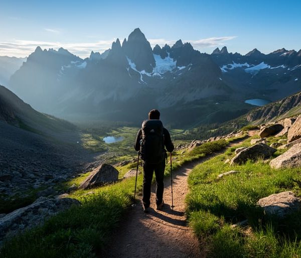
Silverthorne sits at the heart of Summit County’s trail network, offering 11 distinct hiking routes that range from easy lakeside strolls to challenging alpine scrambles above treeline. You’ll find trails that suit every fitness level within a 20-minute drive, whether you’re looking for a quick family-friendly outing or a full-day adventure into the backcountry. The elevation here starts at 8,790 feet and climbs past 13,000 feet on the most ambitious routes, so come prepared with layers and plenty of water.
We’ve spent years exploring these trails during every season and scouting routes that deliver genuine mountain experiences without the crowds you’ll face in nearby Breckenridge or Vail. Each recommendation below includes real trail conditions, accurate distance and elevation gain, and the practical details you need about parking, water sources, and wildlife encounters. Summer afternoons bring predictable thunderstorms, so plan your summit attempts for early morning starts. The thin air at this altitude demands respect, even on moderate trails, and afternoon lightning is serious business above treeline.
How We Selected These Silverthorne Hiking Trails
Choosing the right trails for this guide meant more than scrolling through popular hiking apps. We spent months exploring the Silverthorne area, hitting the trails in different seasons and talking with rangers, gear shop staff, and fellow hikers who know these mountains intimately. The local hiking community around Dillon and Silverthorne provided invaluable insights about which trails consistently deliver memorable experiences and which ones to skip.
Our selection process focused on several core criteria:
- Proximity to Silverthorne, with trailheads accessible within a 20-minute drive
- Scenic variety including alpine lakes, summit views, waterfalls, and wildflower meadows
- Difficulty spread from easy family walks to challenging high-altitude climbs
- Trail maintenance quality and clear signage for safety
- Year-round appeal with consideration for seasonal highlights
We prioritized trails that show the full character of this region, not just the most Instagrammed spots. That means including quieter paths alongside the popular favorites, ensuring you’ll find options whether you’re seeking solitude or joining the weekend crowd. Each trail earned its place by offering something distinct, whether that’s a unique viewpoint, exceptional wildflower displays, or a chance to spot wildlife in their natural habitat. We also checked recent trail reports and maintenance updates to confirm these routes remain in good condition for 2026, so you’re getting current, reliable recommendations you can actually use this season.
1. Lily Pad Lake Trail, Family-Friendly Alpine Beauty
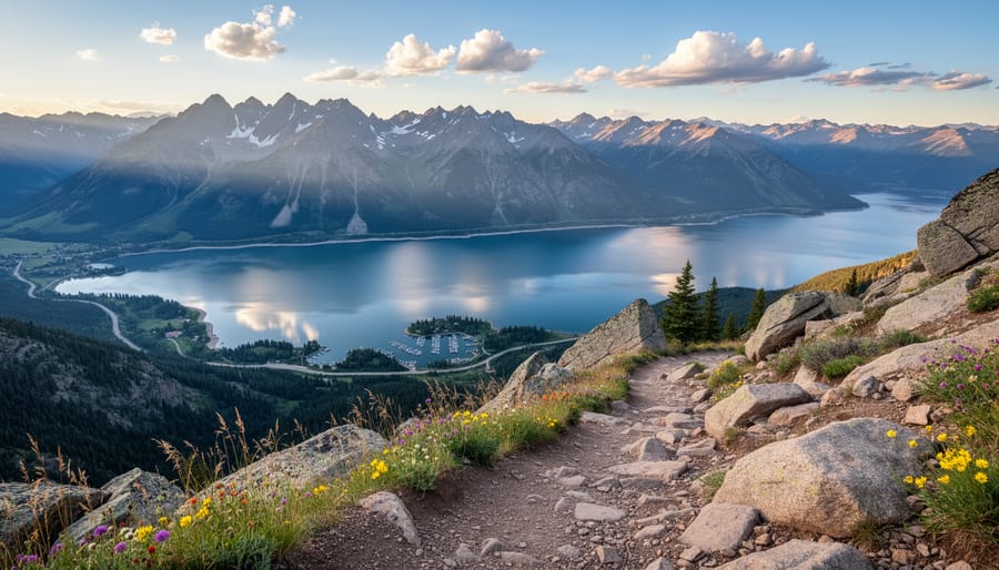
Tucked into the Eagles Nest Wilderness, Lily Pad Lake Trail delivers stunning alpine scenery without punishing your legs or your kids’ patience. This 3-mile round-trip hike climbs just 340 feet, making it genuinely accessible for families with young children, first-time mountain hikers, and anyone wanting a gentle taste of Colorado’s high country.
The trail follows a well-maintained path through mixed conifer forest before opening into wildflower-carpeted meadows. Between late June and early August, the route explodes with Indian paintbrush, columbine, lupine, and alpine sunflowers. The finale is a serene alpine lake ringed by lily pads (hence the name) and framed by rugged peaks, a perfect lunch spot where kids can explore the shoreline while you soak in the views.
You’ll find the trailhead at the end of Mesa Cortina Road, about 5 minutes north of Silverthorne. Parking fills quickly on summer weekends, so arrive before 8 a.m. or consider a weekday visit. The lot holds roughly 20 vehicles, with roadside overflow when it’s busy.
Plan your trip between mid-June and September for snow-free conditions. July and early August offer peak wildflowers, while September brings golden aspens and fewer crowds. Afternoon thunderstorms develop frequently in summer, so start early and turn back if clouds build. Bring plenty of water, snacks, and sunscreen, the exposed meadow sections offer little shade.
2. Mesa Cortina Trail, Quick Summit with Panoramic Views
Just minutes from downtown Silverthorne, Mesa Cortina Trail delivers remarkable payoff for minimal effort. This 4.6-mile out-and-back route climbs roughly 1,100 feet to a summit offering sweeping 360-degree views of the Tenmile Range, Dillon Reservoir, and the valleys below.
The trail starts steep, switchbacking through a brief forested section before breaking into open meadows. Once you’re above treeline, you’ll stay exposed for most of the climb. That openness means big sky views and wildflowers in July, but it also means full sun exposure. Bring sunscreen, a hat, and plenty of water. On hot afternoons, there’s zero shade to escape into.
The final push to the summit involves rocky, uneven terrain. Sturdy footwear makes a difference here. Once you reach the top, take your time scanning the horizon. You’ll spot Ptarmigan Peak to the south, the Gore Range stretching north, and the glittering expanse of Dillon Reservoir directly below.
Most hikers complete the round trip in two to three hours, making Mesa Cortina ideal for a morning adventure that leaves your afternoon free. The trailhead sits right off Rainbow Drive in Silverthorne, with a small parking area that fills quickly on summer weekends. Arrive before 8 a.m. to snag a spot and avoid the midday heat.
3. Ptarmigan Peak Trail, High-Altitude Challenge
Ptarmigan Peak Trail delivers a serious high-altitude adventure for experienced hikers willing to tackle a strenuous 9-mile round trip with roughly 3,400 feet of elevation gain. This isn’t a casual morning stroll, you’ll climb well above 12,000 feet, crossing into true alpine tundra where oxygen thins and weather changes fast.
The scenery rewards your effort. Once you break treeline around 11,500 feet, you’ll traverse windswept tundra dotted with cushion plants and delicate alpine wildflowers that bloom in brief summer bursts. The final push to the summit offers sweeping views across the Tenmile Range and down to Dillon Reservoir far below. On clear days, you can spot peaks stretching into distant mountain ranges.
Wildlife encounters add excitement to this trail. Mountain goats often graze the rocky slopes near the summit, and yellow-bellied marmots whistle warnings from boulder fields. Watch for pikas darting between rocks and keep your eyes on the sky for raptors riding thermals.
Start before dawn, seriously. Afternoon thunderstorms build rapidly above treeline, and you don’t want to be exposed on the ridge when lightning starts. Aim to summit by noon and descend quickly if clouds gather. This trail demands solid fitness, previous high-altitude experience, and respect for Colorado’s volatile mountain weather. Turn back if conditions deteriorate; Ptarmigan Peak will be there another day.
4. Officers Gulch Trail, Wildflower Wonderland
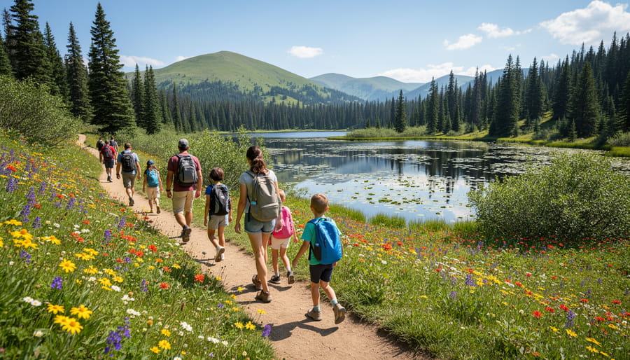
Officers Gulch Trail earns its reputation as one of Summit County’s most colorful hikes when wildflowers explode across the meadows in mid-to-late summer. This 3.5-mile out-and-back trail climbs gradually through mixed aspen and conifer forest before opening into expansive wildflower fields that rival any botanical garden display.
The trail starts at 9,710 feet and gains roughly 1,000 feet to reach the upper meadows. You’ll cross Officers Gulch Creek multiple times, usually easy rock-hops by late July, though earlier in the season you might get your boots wet. The stream provides a pleasant soundtrack throughout the hike and keeps the surrounding vegetation lush.
Peak wildflower season typically hits during the last two weeks of July through early August, when you’ll see paintbrush, columbine, lupine, and elephant’s head covering the hillsides in purple, red, yellow, and pink. The color show varies by elevation, so even if you’re a week early or late, you’ll catch something blooming.
The trailhead sits directly off I-70 at exit 218, making it one of the most accessible trails from Silverthorne, just a five-minute drive. Parking fills quickly on summer weekends, so arrive before 8 a.m. or after 3 p.m. The small lot holds about 15 vehicles, with limited roadside parking available. Despite the highway proximity, the trail quickly immerses you in mountain quiet, and the visual payoff makes this moderate climb absolutely worth the effort.
5. Buffalo Cabin Trail, Historical Mountain Escape
The Buffalo Cabin Trail offers something most Summit County hikes don’t: a tangible connection to Colorado’s mining past at the end of your journey. This 6-mile round-trip adventure combines manageable terrain with historical intrigue, making it ideal for hikers who want substance without the summit-chasing crowds.
The trailhead sits off Buffalo Mountain Road, where you’ll immediately enter dense lodgepole pine and spruce forest. The first mile climbs steadily but gently through this shaded corridor, a welcome respite on hot summer days. You’ll gain roughly 1,000 feet over the entire route, spread evenly enough that it never feels punishing.
Around the 2-mile mark, the forest opens into expansive wildflower meadows where lupine, paintbrush, and columbine create colorful displays from mid-July through August. Buffalo Mountain’s distinctive profile dominates the western skyline here, and you’ll likely have these views mostly to yourself. This trail sees a fraction of the traffic that popular routes like Officers Gulch attract.
The historic cabin, built in the 1930s by a prospector, still stands in remarkable condition thanks to preservation efforts. It’s not open for entry, but you can examine the hand-hewn logs and imagine the solitude those early residents experienced. The clearing around the cabin makes an excellent lunch spot before retracing your steps.
Expect muddy conditions in the meadow sections through late June. The trail is dog-friendly but requires leashes near the cabin to protect the historic site.
6. North Rock Creek Trail, Waterfall & Forest Serenity
North Rock Creek Trail delivers a refreshing escape into dense evergreen forest where the sound of rushing water replaces highway noise. This 4-mile out-and-back route parallels Rock Creek as it tumbles through a shaded canyon, offering welcome relief on hot summer days when exposed alpine trails feel punishing.
The trail gains only about 600 feet in elevation, making it accessible for moderately fit hikers while still providing enough challenge to feel rewarding. You’ll cross wooden footbridges over tributary streams and navigate occasional rocky sections, but nothing technical. The real draw here is the lush forest environment, towering spruce and fir create a canopy that keeps temperatures noticeably cooler than surrounding areas.
Seasonal waterfalls appear along the creek corridor during spring runoff and after heavy rains, typically from late May through early July. By midsummer these dwindle to gentle cascades, but the creek itself flows year-round, providing constant auditory ambiance. Watch for wildlife in the undergrowth: deer frequent this corridor, and you might spot Clark’s nutcrackers in the canopy.
Dogs love this trail since the creek offers multiple access points for cooling off. Keep them leashed and under control, especially where the trail narrows near drop-offs.
From Silverthorne, take Highway 9 north approximately 4 miles toward Kremmling. Turn right onto Rock Creek Road and follow it 2 miles to the signed trailhead parking area on the left. Arrive early on weekends since the small lot fills quickly.
7. Tenderfoot Mountain Trail, Local Favorite with Lake Views
Tenderfoot Mountain Trail consistently ranks among Silverthorne locals’ top picks for good reason, this 5.4-mile loop delivers knockout views of Dillon Reservoir without the brutal elevation gain of higher peaks. You’ll climb roughly 1,100 feet through varied terrain that keeps the hike interesting from start to finish.
The trail begins in shaded forest before breaking into open meadows where wildflowers explode with color from mid-July through August. Lupine, Indian paintbrush, and alpine sunflowers blanket the hillsides during peak bloom. Once you reach the upper sections, the panoramic views unfold: Dillon Reservoir sparkles below while the Tenmile Range and Gore Range frame the horizon.
What makes this trail special is its accessibility combined with genuine alpine character. The moderate rating holds true, expect some rocky sections and steeper pitches, but nothing technical. Most hikers complete the loop in three to four hours, making it perfect for a half-day adventure.
Locals know to hit this trail early on summer weekends to beat crowds and afternoon thunderstorms. The exposed upper portions leave you vulnerable to lightning, so plan accordingly. Trail conditions vary dramatically by season: snow lingers into late June at higher elevations, while fall transforms the aspen groves into golden galleries by late September. Spring can be muddy as snowmelt saturates the lower sections.
The trailhead sits just minutes from downtown Silverthorne, making it an easy add to any Dillon area itinerary.
8. Eccles Pass Trail, Backcountry Gateway
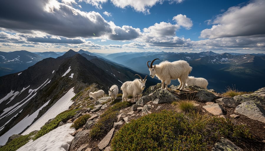
Eccles Pass Trail opens the door to some of the most pristine backcountry terrain near Silverthorne, making it a favorite among hikers ready to venture beyond the day-trip crowds. This 7-mile out-and-back route earns its moderate-to-difficult rating through a steady 1,800-foot elevation climb that tests your conditioning while rewarding persistence with increasingly spectacular alpine scenery.
The trail begins in dense evergreen forest before gradually opening into subalpine meadows dotted with wildflowers in July and August. As you climb, the path becomes rockier and more exposed, eventually cresting Eccles Pass at roughly 11,600 feet. From the pass, ambitious hikers can access several stunning alpine lakes tucked into the surrounding basins, perfect for extended backpacking trips if you want to explore deeper into the wilderness.
Navigation requires attention here. The trail is well-defined to the pass, but beyond that point, side trails and game paths can confuse first-timers. Download offline maps before you go, and carry a compass or GPS device. Weather changes quickly at this elevation, so start early and turn back if afternoon thunderclouds build.
Practice solid wilderness etiquette on this less-traveled route. Pack out everything you bring in, stay on established trails to protect fragile alpine vegetation, and camp at least 200 feet from lakes and streams if you are overnighting. The solitude you will find here depends on everyone respecting these wild spaces.
9. South Willow Falls Trail, Easy Cascade Experience
South Willow Falls Trail delivers waterfall rewards without the grueling effort. This 2.5-mile out-and-back route climbs just 420 feet, making it perfect for families with young children or anyone wanting a quick nature fix before lunch.
The trail follows South Willow Creek through a shaded forest corridor, keeping hikers cool even on warm summer days. Kids can explore alongside the creek at several safe access points, though parents should pack must-have survival items like extra layers and first aid supplies. The gentle, well-maintained path rarely intimidates beginners, and the constant sound of rushing water makes distance feel shorter.
Time your visit for late May through mid-June to catch the falls at peak flow. Snowmelt transforms the cascade into a thundering display that sprays mist across the viewing area. By August, flow diminishes considerably, though the hike remains pleasant.
The trailhead sits just off Highway 9 north of Silverthorne, with ample parking and vault toilets. Most families complete the round trip in under two hours, leaving plenty of time for other activities. Even on this short walk, carry essential survival items and review backcountry safety priorities before heading out, mountain weather changes fast, even near town.
10. Peak One Trail, Advanced Alpine Summit
Peak One Trail stands as the most demanding hike on this list, reserved for experienced hikers seeking a genuine alpine challenge. This 12-mile round-trip summit push climbs approximately 3,400 feet to reach Peak One’s 12,805-foot summit, delivering unmatched views of the Tenmile Range, Dillon Reservoir, and distant peaks stretching across the Continental Divide.
The trail begins innocuously through forested switchbacks before breaking into open alpine terrain around 11,500 feet. Beyond treeline, the route steepens considerably, traversing exposed ridgelines where every step demands focus. The final summit approach involves scrambling over loose rock and navigating narrow sections where a misplaced foot could spell trouble. Weather becomes your primary concern at this elevation, afternoon thunderstorms materialize quickly in summer, turning exposed ridges into lightning magnets.
Start before dawn to summit by noon and descend safely ahead of weather buildups. Bring layers for temperature swings of 30 degrees or more between trailhead and summit, and pack your gear checklist essentials including navigation tools, emergency shelter, and extra food. Understanding basic survival priorities proves crucial if conditions deteriorate unexpectedly.
This trail demands respect, preparation, and honest self-assessment of your fitness and experience. When conditions align and you’re properly equipped, Peak One delivers an unforgettable Colorado summit experience that justifies every challenging step.
11. Rainbow Lake Trail, Remote Mountain Lake Paradise
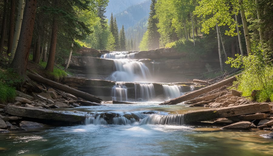
Rainbow Lake Trail delivers what many hikers crave: a payoff worthy of the effort. This moderate 6.8-mile round-trip trek requires commitment, but the destination, a crystalline alpine lake cradled by rugged peaks, makes every step worthwhile.
The trail climbs steadily but never brutally, gaining roughly 1,100 feet through wildflower-studded meadows that explode with color from mid-July through early August. Expect paintbrush, lupine, and columbine carpeting the slopes as you ascend. The approach takes you through mixed conifer forest before breaking into open terrain where the views expand with each switchback.
Rainbow Lake itself sits at approximately 11,200 feet, surrounded by dramatic rock faces that create stunning reflections on calm mornings. Photographers should arrive early, the still water mirrors the surrounding peaks beautifully before afternoon breezes ripple the surface. The lake’s remote location means fewer crowds than more accessible destinations, though you’ll rarely have it entirely to yourself on summer weekends.
Plan for a half-day commitment at minimum. The longer approach demands you pack adequate water, snacks, and layers for changing conditions at elevation. Bring your camp survival essentials if you’re considering an overnight stay near the lake, as weather can shift rapidly above treeline. Check trailhead conditions before heading out, lingering snowfields can obscure the path well into July during heavy snow years.
Essential Trail Safety & Planning Tips for Silverthorne Hiking
Hiking in the Silverthorne area demands more preparation than lower-elevation trails. The combination of high altitude, rapidly changing weather, and remote terrain means planning ahead isn’t optional, it’s essential for a safe and enjoyable experience.
Start your altitude adjustment before tackling longer or higher trails. If you’re arriving from sea level, spend a day or two at lower elevations around Silverthorne (around 9,000 feet) before attempting peaks above 12,000 feet. Drink more water than you think you need, pace yourself, and don’t push through headaches or nausea. Altitude sickness can ruin a trip quickly, and there’s no shame in turning back.
Weather in the Colorado Rockies shifts fast. Mornings often start clear and calm, then clouds build by midday, bringing lightning, hail, and sudden temperature drops. Pack layers even on warm summer days: a moisture-wicking base layer, insulating mid-layer, and waterproof shell. Bring a headlamp, first-aid supplies, navigation tools, and enough food and water for longer than you expect to be out.
Wildlife encounters happen. Black bears and moose live in these mountains. Make noise on blind corners, store food properly, and give animals plenty of space, especially moose with calves. Never approach or feed wildlife.
Check trail conditions before you leave. Snow lingers on high passes well into July, and afternoon storms can make creek crossings dangerous. The Forest Service and local ranger stations provide current updates. Always tell someone your plan and expected return time. Cell service is spotty or nonexistent on most trails.
Practice Leave No Trace principles: pack out all trash, stay on established paths, and keep dogs leashed where required. These trails stay beautiful because hikers take care of them.
When to Hike Near Silverthorne: Seasonal Considerations
Silverthorne’s hiking season varies dramatically with elevation, and timing your visit correctly makes all the difference between muddy slogs and perfect trail conditions.
Late May to Mid-June: Transition Period
Lower-elevation trails like North Rock Creek and South Willow Falls open first, often by late May. Higher routes remain buried under several feet of snowpack. This period offers solitude but limited options.
Late June Through July: Prime Wildflower Season
By late June, most trails become passable, though lingering snowfields may require navigation around wet sections. Officers Gulch explodes with wildflowers in mid-to-late July, transforming meadows into color-splashed canvases. Lily Pad Lake hits peak bloom around the same time. Afternoon thunderstorms become frequent, so start hikes by 7 a.m. and plan to descend by 1 p.m.
August Through Early September: Peak Season
Trails reach optimal condition with minimal mud, stable weather patterns, and full accessibility. Expect crowds on weekends. Summit attempts like Peak One and Ptarmigan Peak face the most predictable conditions during this window.
Mid-September to October: Fall Colors
Aspen groves along trails like Tenderfoot Mountain and Buffalo Cabin blaze gold, typically peaking around late September. Nights turn cold, and snow can arrive without warning above 11,000 feet by early October.
November Through April: Winter Domain
Most trails require snowshoes or skis. Only experienced winter hikers should attempt high-elevation routes during these months.
Where to Stay While Exploring Silverthorne Trails
After a long day on the trails, you’ll need a comfortable base camp to rest and recharge. Silverthorne and the surrounding Summit County area offer excellent lodging options for every camping style and budget.
For traditional campers, the Prospector Campground sits just minutes from town with RV hookups and tent sites. Heaton Bay Campground on the north shore of Dillon Reservoir provides stunning water views and easy access to both Mesa Cortina and Tenderfoot Mountain trailheads. Peak One Campground offers a more rustic experience with sites nestled among the pines.
RV travelers will find several parks with full hookups, including Tiger Run Resort and Blue River Campground, both offering convenient proximity to trailheads and town amenities. Many sites fill quickly during summer weekends, so reserve ahead.
If you prefer four walls and a roof, Silverthorne has numerous vacation rentals and cabins that put you within a 15-minute drive of most trailheads. Staying in nearby Dillon or Frisco expands your options while keeping trail access convenient. Most accommodations sit between 9,000 and 9,100 feet elevation, giving your body a head start on acclimatization before tackling higher trails.
Silverthorne’s hiking trails deliver something for everyone, from gentle lakeside strolls perfect for young families to demanding alpine summits that test experienced mountaineers. Whether you’re seeking wildflower meadows, cascading waterfalls, or sweeping reservoir views, this corner of Colorado rewards every effort with unforgettable scenery. Start with trails that match your current fitness level and experience, then gradually work toward the more challenging routes as you build confidence and acclimatization.
What’s the best beginner trail near Silverthorne?
Lily Pad Lake Trail offers an easy 3-mile round trip with minimal elevation gain, making it perfect for families and first-time mountain hikers. South Willow Falls Trail is another excellent beginner option at just 2.5 miles.
Which trails allow dogs?
Most trails in the area welcome leashed dogs, with North Rock Creek Trail being particularly popular for canine companions. Always check current regulations before you go, as some wilderness areas have seasonal restrictions.
Do I need a parking pass?
Many trailheads require either a daily parking fee or an America the Beautiful Pass. Some roadside trailheads near Silverthorne offer free parking, but arrive early during peak summer weekends.
Should I worry about altitude sickness?
Silverthorne sits at 9,000 feet, and several trails climb above 12,000 feet. Spend a day acclimating before tackling high-elevation hikes, stay hydrated, and descend immediately if you experience severe headaches or nausea.
When is the best time to hike these trails?
Mid-July through September offers the most reliable trail access and weather. Late July brings peak wildflowers, while September delivers golden aspen colors and fewer crowds.
Remember that mountain weather changes rapidly, afternoon thunderstorms are common in summer, and proper preparation makes the difference between a memorable adventure and a dangerous situation. Respect the environment by staying on established trails, packing out everything you bring in, and giving wildlife plenty of space. The mountains will be here for future generations if we all do our part to protect them. Ready to plan your full camping adventure around these incredible trails? Explore our guides to campgrounds, RV sites, and outdoor survival tips to make the most of your Silverthorne experience.