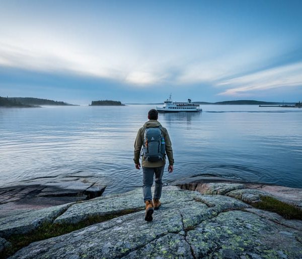
Isle Royale National Park sits on a remote wilderness island in northwestern Lake Superior, accessible only by boat or seaplane. Unlike most national parks where you can simply drive up to the entrance, reaching this isolated gem requires deliberate planning and a genuine commitment to adventure. The park’s location, roughly 56 miles from Michigan’s Upper Peninsula and 18 miles from the Minnesota shore, makes it one of the least visited national parks in the country, but that remoteness is precisely what draws seasoned outdoor enthusiasts to its rugged shores.
The park occupies the largest island in Lake Superior, along with approximately 400 smaller surrounding islands, creating a true wilderness archipelago. You’ll find yourself in Michigan’s waters, despite being closer to Minnesota, a quirk of geography that adds to the park’s unique character. Three main entry points serve visitors: Rock Harbor on the northeast end, Windigo on the southwest, and the mainland visitor center in Houghton, Michigan, where many journeys begin.
Getting there requires choosing between passenger ferries from Houghton, Copper Harbor, or Grand Portage, Minnesota, or seaplane services that can whisk you directly to the island. No private vehicles are allowed on Isle Royale, so once you arrive, you’re committed to exploring by foot, canoe, or kayak. This car-free environment transforms your visit into a genuine backcountry experience where solitude and wildlife encounters, including the famous wolf and moose populations, become part of your daily rhythm rather than fleeting moments.
Where Is Isle Royale National Park Located?
Isle Royale National Park sits on an isolated archipelago in northwestern Lake Superior roughly 56 miles from the nearest Michigan shoreline and 18 miles from Minnesota’s coast. This is no roadside national park. The main island stretches 45 miles long and nine miles wide at its widest point, positioned near Michigan and Ontario borders in one of the most remote corners of the Great Lakes.
The park’s geography sets it apart from nearly every other national park in the system. While technically part of Michigan’s Keweenaw County, Isle Royale is actually closer to Minnesota and the Canadian border than to most of Michigan’s mainland. Lake Superior’s cold, often turbulent waters surround the entire chain of islands, creating a natural barrier that has preserved the ecosystem and kept visitor numbers low.
This isolation is exactly what draws wilderness seekers. The island ecosystem has evolved separately from the mainland for thousands of years, supporting unique wildlife populations including wolves and moose. There are no bridges, no vehicle ferries, and no casual drive-by visits. The lake itself acts as both protector and gatekeeper, ensuring that everyone who arrives has made a deliberate choice to experience genuine backcountry.
The surrounding waters extend hundreds of feet deep in places, and the island’s rocky shores and inland ridges offer dramatic elevation changes rare for a Great Lakes location. You’re not just visiting a park. You’re committing to a real journey into one of the last truly isolated wilderness areas in the lower Great Lakes region.

How to Reach Isle Royale: Access Routes and Entry Points
1. Ferry Access
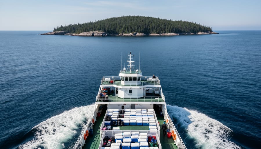
Ferry service offers the most practical way to reach Isle Royale with camping gear in tow. Unlike seaplanes with strict weight limits, ferries welcome backpacks, tents, coolers, and all the equipment serious backcountry campers need for multi-day wilderness trips. You’ll board from mainland ports and enjoy a journey across Lake Superior that becomes part of the adventure itself.
The crossing takes several hours, depending on your departure point and destination on the island. This isn’t a quick hop, expect to spend a solid chunk of your day on the water. Many visitors find this transit time valuable for spotting wildlife, scanning the horizon for the island’s silhouette, and mentally shifting into wilderness mode before stepping onto remote terrain.
Ferry operators run seasonal schedules, typically from late spring through early fall when Lake Superior weather permits safe passage. Book your tickets well ahead of peak summer months, as capacity fills fast with campers heading to this isolated national park. The boat ride can be choppy, Lake Superior earns its reputation for unpredictable conditions even in summer, so pack motion sickness remedies if you’re prone to seasickness.
Traveling by ferry means you control your gear load. Bring stoves, bear canisters, fishing equipment, and layered clothing without worrying about airline-style restrictions. That flexibility makes ferry access the go-to choice for visitors planning serious backcountry exploration rather than quick day trips.
2. Seaplane Access
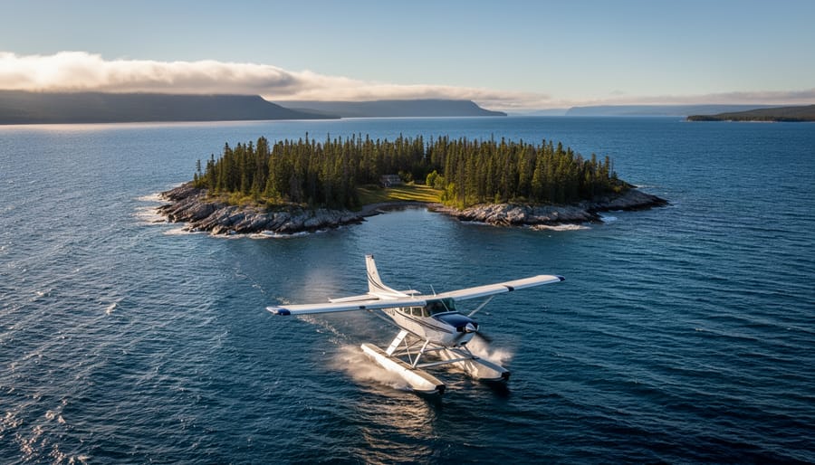
Seaplanes offer the fastest and most exhilarating way to reach Isle Royale, cutting travel time to roughly 35-45 minutes compared to several hours by ferry. If you’re short on time or eager to maximize your days exploring the wilderness, flying in transforms the journey itself into a highlight of your trip.
The aerial approach gives you sweeping views of Lake Superior’s vastness and Isle Royale’s rugged coastline that you simply can’t get from water level. You’ll spot remote coves, forested ridges, and the island’s distinctive shape sprawled across the blue expanse below. For photographers and first-time visitors, this bird’s-eye perspective is unforgettable.
However, seaplane access comes with trade-offs. Weight restrictions are strict, typically around 25-50 pounds per person for gear, so you’ll need to pack light and strategic. Bulky camping equipment, oversized backpacks, or group gear won’t make the cut. This makes seaplanes ideal for solo travelers, couples on shorter trips, or experienced backcountry campers who know how to minimize their load.
Weather also plays a bigger role with seaplanes than ferries. Flights can be delayed or cancelled due to wind, fog, or rough water conditions on the lake. Build flexibility into your schedule and prepare backup plans, especially during shoulder season when Lake Superior’s moods shift quickly.
3. Private Boat Access
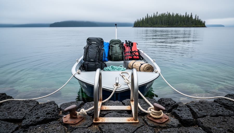
Arriving by private boat offers the ultimate freedom to explore Isle Royale on your own schedule. You can dock at either Rock Harbor or Windigo, giving you flexibility to start your adventure from whichever side of the island fits your route.
Lake Superior demands serious respect. Even experienced boaters need to prepare for rapidly changing conditions, what starts as a calm morning can turn rough within hours. The lake’s cold water (rarely above 55°F even in summer) makes capsizing particularly dangerous. Check marine forecasts obsessively before departure and during your stay, and don’t hesitate to delay crossing if conditions look questionable.
You’ll need to obtain a docking permit from the National Park Service, which you can arrange before arrival or at the ranger station when you dock. Moorings are available at both main harbors, but they fill quickly during peak summer weeks. First-come slips sometimes open up, but banking on one is risky if you’re hauling a week’s worth of gear and food.
Navigation equipment is non-negotiable: GPS, charts, compass, and a VHF radio. Cell service vanishes miles before you reach the island. Bring backup fuel, underestimating the return journey is a mistake you only make once. The crossing from the Michigan mainland runs roughly 50-60 miles depending on your launch point, a significant open-water passage that tests both boat and captain.
Main Areas and Entry Points to Know
4. Rock Harbor Area
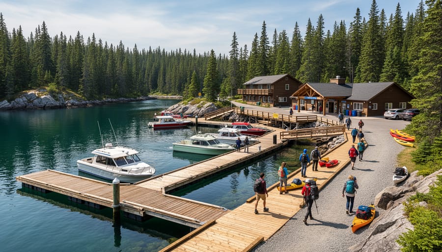
Rock Harbor sits on the northeastern shore of Isle Royale and serves as the park’s busiest gateway. Most visitors arriving by ferry from Michigan’s Copper Harbor or Grand Portage, Minnesota disembark here, making it the natural starting point for exploration. The area offers the most developed services you’ll find on the island, though “developed” is relative in this roadless wilderness.
You’ll find a visitor center with park rangers who can answer questions, update you on trail conditions, and help refine your backcountry plans. The Rock Harbor Lodge operates nearby for visitors who prefer a roof and restaurant meals over tent camping. A small camp store stocks essentials like fuel canisters, freeze-dried meals, and last-minute gear, though prices reflect the remote location.
For campers, several established sites ring the harbor within a few miles. Three Mile Campground and Lane Cove are popular first-night stops for backpackers starting multi-day treks. From Rock Harbor, major trails branch out toward the island’s interior ridges and the scenic coastline. The Greenstone Ridge Trail, the park’s backbone route, is easily accessible from here.
Rock Harbor’s combination of services, camping options, and trail access explains its popularity. It’s where most first-time visitors get their bearings before heading into the true backcountry, making the transition from boat to wilderness smoother than jumping straight into isolation.
5. Windigo Area
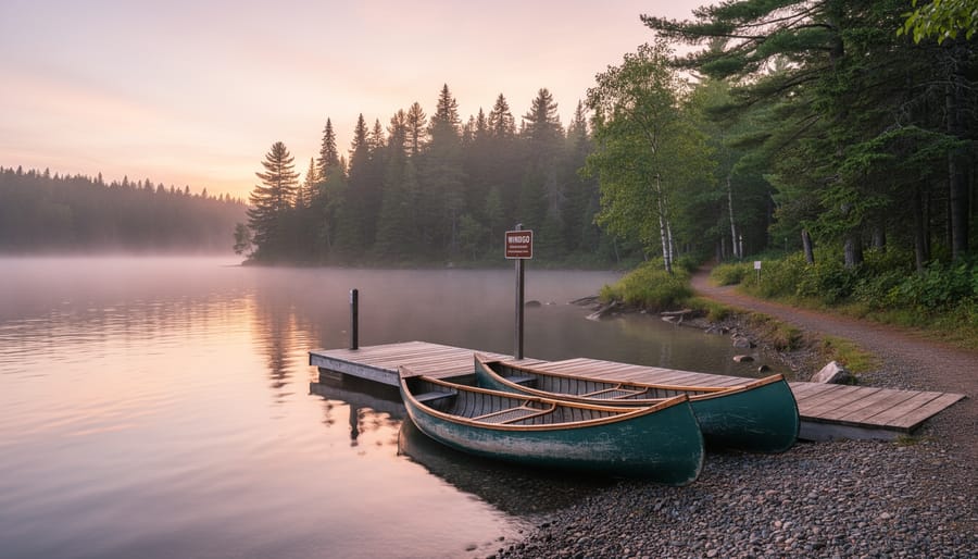
Windigo sits on the southwest end of Isle Royale and offers a completely different vibe from the busier Rock Harbor. If you’re arriving from Grand Portage, Minnesota, this is your landing point, and you’ll immediately notice the quieter, more laid-back atmosphere. Fewer visitors choose this entry, which means more solitude on the trails and around the campsites.
The campground at Windigo provides easy access to the visitor center, where rangers can orient you to the western side of the island. You’ll find basic amenities here: shelters, a camp store (with limited hours and inventory), and drinking water. The sites fill up less quickly than Rock Harbor, but reservations are still smart during peak summer weeks.
From Windigo, you can tackle several excellent trails without backtracking east. The Feldtmann Lake Trail loops through forests and beaver ponds, offering a gentler introduction to the island’s terrain. More ambitious hikers can connect to the Greenstone Ridge Trail, the island’s spine, and work their way across the park. The western shoreline also provides stunning Lake Superior views without the crowds.
Pack everything you need before arriving, Windigo’s remoteness means limited resupply options. The ferry schedule from Grand Portage is less frequent than Houghton’s service, so plan your arrival and departure carefully. This entry point rewards visitors who value quiet wilderness over convenience.
6. Houghton Mainland Visitor Center
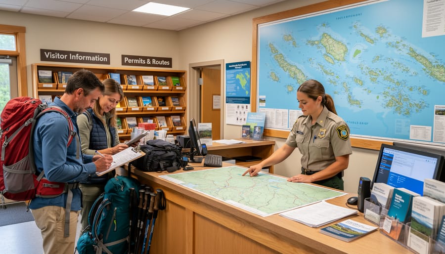
The Houghton visitor center sits on the mainland in Michigan’s Upper Peninsula, making it your last outpost before committing to the island journey. Stop here before you board any ferry or seaplane, it’s not just a formality, it’s your best chance to get oriented and avoid rookie mistakes once you’re disconnected from civilization.
Rangers staff the center year-round and can answer questions about current conditions, trail status, and what to expect during your stay. You’ll find detailed maps, backcountry camping permits, and updated weather forecasts for Lake Superior, critical information since conditions on the water can shift fast. The center also sells any last-minute gear you might need and offers educational exhibits about the island’s ecology and history.
Think of Houghton as your final checkpoint. Double-check your packing list, confirm your ferry or flight reservations, and ask any lingering questions while you still have cell service and internet access. Once you leave this building, you’re entering a wilderness where there’s no running to the store for forgotten items or Googling trail conditions. The rangers here know what inexperienced visitors consistently overlook, so tap into that knowledge before you cast off.
Practical Travel Information for Your Visit
Planning a trip to Isle Royale requires more advance preparation than most national parks due to its remote island location and limited seasonal access. The park operates from mid-April through October, with ferry and seaplane services running only during these months, winter ice makes Lake Superior crossing impossible. Book your transportation and camping permits several months ahead, especially for July and August visits, as capacity is limited and spots fill quickly.
Because the island has no shops, restaurants, or gear rentals, you’ll need to arrive completely self-sufficient. Your packing list should cover the essential survival items plus extras specific to this environment:
- Multi-day food supply (all meals, snacks, and energy reserves)
- Water purification system (tablets or filter for lake and stream water)
- Layered clothing for dramatic temperature swings, even in summer
- Rain gear and waterproof pack covers for sudden Lake Superior storms
- First aid kit with blister treatment and any prescription medications
- Bear-proof food storage bags (provided at campsites but bring extras)
- Navigation tools including map, compass, and offline GPS
Your wilderness survival gear matters even more here since you can’t simply walk out if something goes wrong. Cell service and internet don’t exist on the island, satellite devices work, but plan to be truly disconnected. The park requires backcountry camping permits, which you’ll obtain when you arrive at Rock Harbor or Windigo, but ferry reservations must be made online or by phone beforehand. Weight restrictions vary by transportation method, with seaplanes limiting you to about 50 pounds per person including gear, while ferries allow more flexibility for kayakers and those carrying heavier loads.
Local Tips for Navigating This Remote Wilderness
Isle Royale’s isolation means this wilderness plays by different rules. Summer doesn’t guarantee warmth here, Lake Superior’s cold water keeps temperatures cooler than you’d expect, and weather can shift from calm to stormy in minutes. Pack layers no matter when you visit, including rain gear and a warm jacket. Check weather basics before you leave the mainland, but understand that conditions on the island may differ significantly from forecasts.
The no-road, no-vehicle environment means you’ll carry everything on your back or in your boat. Plan your packing weight carefully. Most visitors underestimate distances, trails can be rugged and slower going than mainland hikes. Water purification is essential since you’ll be treating lake and stream water for drinking.
Wildlife awareness matters here. Moose roam the island and can be aggressive, especially cows with calves. Give them wide berth, at least 50 feet. Wolves are present but rarely seen. Store all food properly at designated areas or in bear-resistant containers to avoid attracting animals to your campsite.
Communication will be extremely limited. Cell service doesn’t exist across most of the island. Let someone on the mainland know your itinerary and expected return. The park’s isolation means help isn’t quick to arrive if problems develop.
Embrace the disconnected experience rather than fighting it. This remoteness is precisely what makes Isle Royale special, you’ll find a wilderness authenticity that most parks can’t match.
Frequently Asked Questions
Understanding Isle Royale’s unique location and access can feel overwhelming at first, there’s no bridge, no road, no cell service. Here are straight answers to the questions most first-time visitors ask when planning their journey to this remote wilderness.
How far is Isle Royale from the mainland?
The island sits roughly 56 miles from the Michigan shore at Copper Harbor and about 18 miles from Minnesota’s Grand Portage. Its remote position in northwestern Lake Superior is what makes this park so special and undeveloped.
Can you drive to Isle Royale?
No, there’s absolutely no way to drive to the island. You must reach it by ferry, seaplane, or private boat, the journey across Lake Superior is mandatory and part of what makes this destination unique.
What’s the easiest way to get there?
The ferry from Houghton or Copper Harbor is the most straightforward option for most visitors. It allows you to bring camping gear and supplies, and you don’t need special equipment or piloting skills.
How long does it take to reach the island?
Ferry crossings typically take three to six hours depending on your departure point and destination (Rock Harbor or Windigo). Seaplanes get you there in about 45 minutes but cost significantly more.
Is the journey worth it?
If you’re seeking true wilderness and solitude, absolutely. The isolation that makes access challenging is exactly what keeps this park pristine and uncrowded, you’ll experience backcountry unlike anywhere else in the Lower 48.
The logistics might seem intimidating if you’re used to drive-in parks, but treat the planning phase as part of your adventure. Stock up on wilderness survival essentials before you leave the mainland, because once you’re on that island, there are no stores or resupply options. Understanding Lake Superior’s unpredictable weather patterns and respecting the environment’s remoteness can genuinely save your life in a place this isolated. The park rewards preparation with an experience you won’t find anywhere else.